
ArcGIS Online
ArcGIS Online is a complete cloud-based GIS mapping software that connects people, locations, and data by using interactive maps.
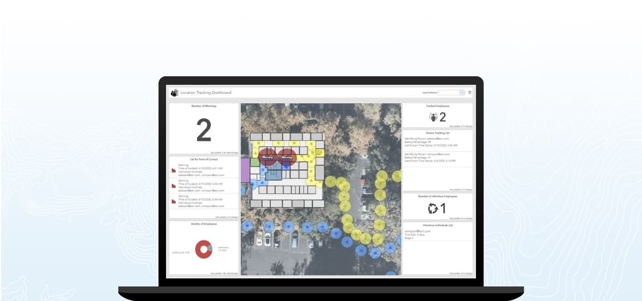
Ensuring a safe and efficient return to business sites requires organizations to proactively assess and reconfigure work spaces to minimize potential contact events. Managers can leverage indoor mapping tools and methodologies for facility planning to address proximity analysis and tracing, density management, and situational awareness to maintain a safe workplace even as incidents occur. Using location intelligence, facility managers can identify high-risk and high-touch locations that need additional safeguards and barriers and understand peak use time to guide sanitization strategies.
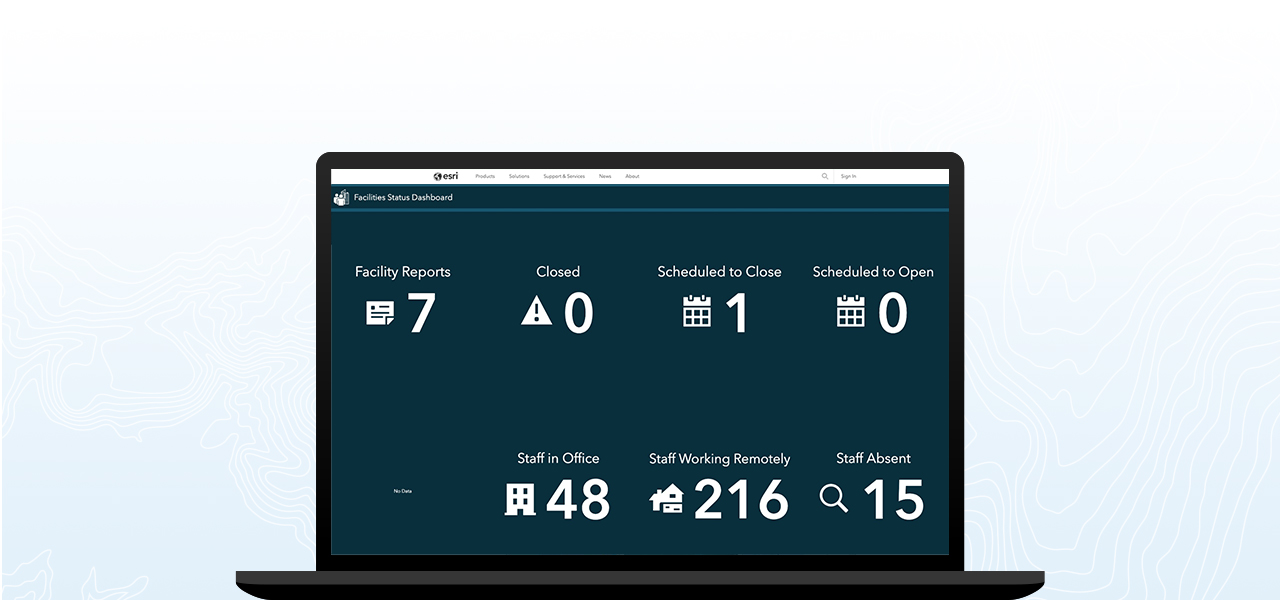
Understanding the operating capabilities of facilities can be a difficult and time-intensive process for decision-makers, often requiring integration of dispersed data from spreadsheets and emails into a static document. Utilizing mobile surveys, organizations can enable field teams to share real-time updates on their facility status from any device. This streamlined approach to data management allows updates from the field to be automatically added to dashboards and web applications for enhanced situational awareness.
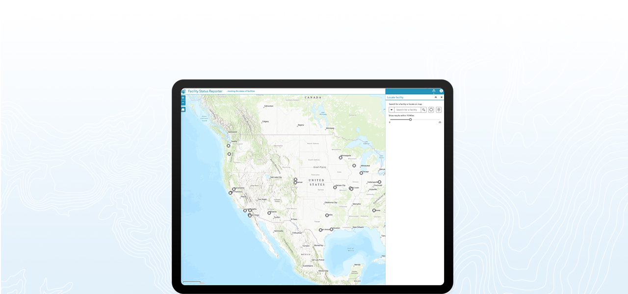
Understanding which facilities are open, closed, or otherwise impacted by the spread of COVID-19 lays the foundation for reallocating resources to meet current and future market opportunities. Organizations can use location intelligence to determine the best use of a site on a hyperlocal scale, whether that be businesses needing to pivot their in-store operating model to accommodate social distancing and online order fulfillment or governments needing to determine how to safely offer civil services to their constituents.
ArcGIS Online is a complete cloud-based GIS mapping software that connects people, locations, and data by using interactive maps.

Survey123 for ArcGIS is a complete, form centric solution for creating smart surveys and forms, collecting data via web or mobile devices, and analyzing results.

ArcGIS Pro is a powerful, single desktop GIS application that provides professional 2D and 3D mapping in an intuitive user interface.

Business Continuity and Recovery
Assess facility status in real time to minimize disruption