User story
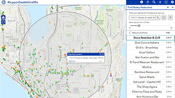
Seattle focuses on economic recovery
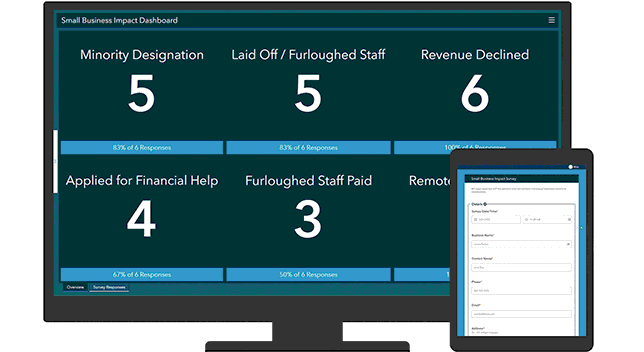
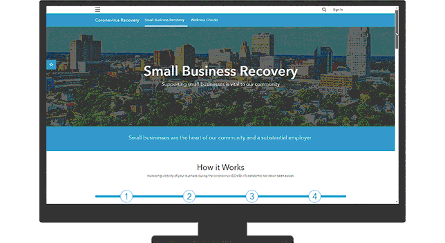
Helping Seattle businesses survive the pandemic requires a location-based solution—connecting citizens with local businesses that are open.

Tools for reopening during COVID-19
Monitor, assess, and communicate with location intelligence
Seattle focuses on economic recovery
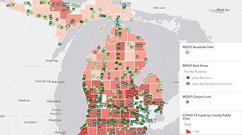
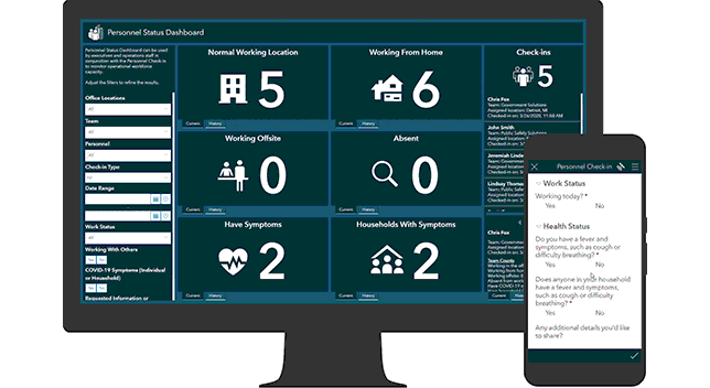
Keeping Michigan residents informed and safe
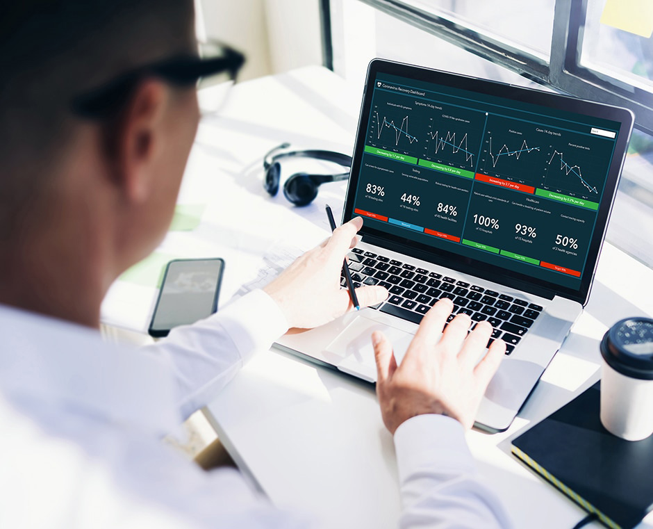
With up-to-date time-enabled maps, monitor the overall cases-per-day trend and the most recent two-week case trends to determine a community's readiness to reopen.

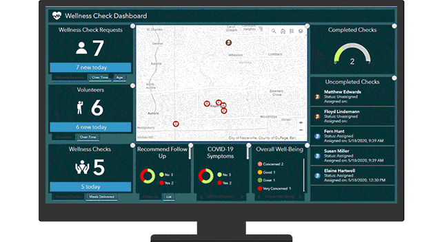
Resilient communities use mapping and analysis to improve surveillance, supplement contact tracing, manage physical distancing in public places, augment services where needed, connect residents to services, mitigate disparities, and regularly assess health system capacity.
Map-based dashboards with key indicators help leaders quickly assess the balance between community wellness and economic reactivation, informing decisions about relaxing or strengthening social distancing measures.
Resilient organizations use mapping to ensure the strength of their supply chain and customer markets, keep track of a distributed workforce and employees in the field, manage indoor spaces for physical distancing, and prioritize employee safety and wellness.
Engage with the community by sharing information about initiatives, priorities, and progress using interactive web maps, dashboard apps, and story maps.
Location intelligence is at the center of a coordinated reopening plan amid coronavirus disease 2019 (COVID-19). It provides leaders with tools to map, analyze, and assess trends and potential impacts, helping balance reopening businesses and the community with public health.
Monitor
Collect public health and economic data using maps and dashboards to monitor reopening benchmarks. Anticipate where to take corrective action.
Assess
Analyze data trends and assess impacts on organizational or community resilience. Target specific actions to mitigate impacts during reopening.
Communicate
Use maps and data to provide context and insights into evolving priorities. Show how you are balancing economic recovery with public health.